[THE LEGEND]
In the time before time, the island’s various climates and unique geography coexisted harmoniously. The lush eastern rainforests of Ga-Wahi (Placeholder name) received a brisk wind and rain from the sea, allowing a tropical paradise to flourish. To the north, the colder atmosphere and elevation of Ko-Wahi made the rainforest unable to survive, causing it to gradually ■■■■■ into a taiga. The mountainous area to the west of Ga-Wahi was a wellspring of life as well. Known as Onu-Wahi, it possessed caverns underground and grassy slopes above. Numerous creatures and plants lived there, adapted to the terrain and elevation. Further south, Onu-Wahi formed a barrier of sorts between Ga-Wahi and Po-Wahi. The Po-Wahi region was cut off from the majority life-giving rain and wind that Ga-Wahi received, but was a place of diverse life as well. A savanna-like area with canyons and wide open grasslands, Po-Wahi relied on the rain that made it over Onu-Wahi to survive. To the west of Po-Wahi, the coastal region of Le-Wahi had a temperate climate that allowed for widespread forests, but not on the same scale or type of Ga-Wahi. This region was famous for its inhabitants that lived in islands floating among the clouds. North of Le-Wahi and south of Ko-Wahi, the island’s volcano bubbled and churned. It rarely erupted, but its heat changed the surrounding area into a unique mini-climate. Hot springs popped up in many areas, from the warm deciduous forested areas near the southern border to the frozen pine forests in the north. Close to the volcano, it was rockier. Geysers dotted the landscape, and closer to the volcano several lava lakes simmered. The climates and organisms existed in total harmony. The island’s inhabitants believed in four primal elements of nature that formed everything in existence through various forms.
Earth, Water, Fire and Air. The four elements lived in harmony… but everything changed when the Fire attacked. Well, it came from the fire. A force of pure Evil arose from Ta-Wahi, laying waste to everything in its path and disrupting the delicate balance of nature. The volcano erupted violently, incinerating the surrounding area. The Evil moved southwards, through the mountains of Onu-Wahi. It sliced up peaks and buried rivers, rending the earth itself. This region is now a desolate wasteland, with the inhabitants forced to live in caves underground. It continued to move southwards, where it laid waste to the fragile ecosystem of Po-Wahi. The rain it received was no longer sufficient to support everything that lived there, with few plants to control erosion. All that remains of the grassy and rocky Po-Wahi is a vast desert, dotted with only a few of the large stone formations that were once widespread. The Evil annihilated everything in its path in some way or another, eventually settling in the southeastern corner of the island… or so the legends say.(edited)
Now it its time for a new legend to begin. A legend that will be certainly be a vital part of… the BIONICLE.
[LOCATIONS]
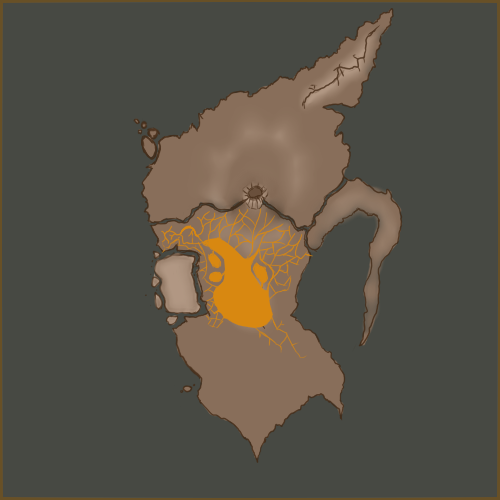
Ko, the northernmost region, is obviously the coldest. That’s where the Ko-Matoran live. It isn’t all cold, though, as the lower portion increases in temperature until it’s about average. The Matoran that live there are deeply attached to the ancient legends surrounding the island, and although not unfounded, have been stereotyped for their stubbornness.
Ta also stays in a relatively normal temperature range, but a large forest inside the area was levelled long ago by a wildfire - although the elders and some skeptics say it was from the Evil. Nearer to the volcano the temperature gets up to baking levels, on all sides, in all territories. Only the Ta-Matoran dare go anywhere near it.
Ga is part rainforest, and part absolute paradise when it isn’t ravaged by the waves. The sides of the region have been worn down by waves, resulting in sandy, soft beaches and a highly elevated plateau. The Matoran there are almost all naturalists, competing heavily with Ko and Ta as to the preservation of the enviroment.
The Majority of Le is not inhabited, but is used as hunting grounds by all Matoran. The Le-Matoran reside in the large, floating island complex, hundreds of feet off the ground, where the air is slightly more thin and Matoran have been whipping around through the skies in complex flying machines. They are still longing for the day when they discover how to fly without the mechanical add-ons.
Onu is almost entirely decimated, due to inexplicable circumstances. Matoran travelling the barren wasteland at day notice the gritty, dead soil is stained a cold and sickly-looking indigo-black, and at night many claim to see apparitions floating about. The Onu-Matoran reside underground using a complicated series of tunnels and air shafts, siphoning in new fresh air and using large crystals rooted into the mountainside to channel sunlight down into their homes.
Shifting sands cover the region of Po, the entire area inhospitable for plantlife. The Matoran that live there daily bring water up from to a massive reservoir used by the populous, as they are the only Matoran capable of drinking salt water and do so heavily. They are also the strongest, yet despite their prowess they have been unable for years to reach the only unexplored portion of their island due to some strange, peculiar power that has claimed many lives.
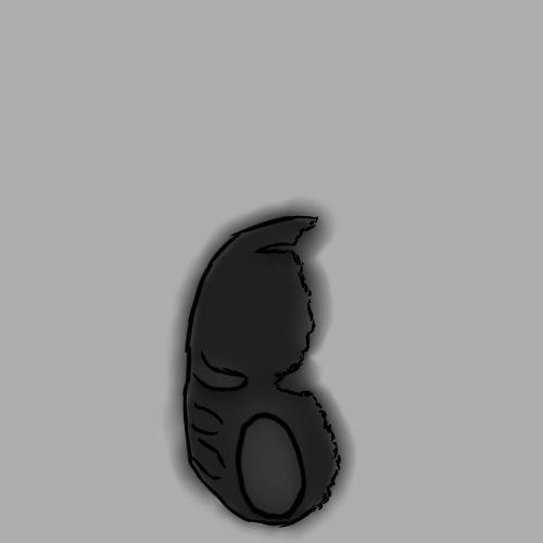
[KANOHI DRAGON]
The tale of the Kanohi Dragon has been passed down for millennia untold. In the time before time was yet to be, the Kanohi Dragon protected the sky as a beautiful shimmering beacon of power. His shining scales shone a brilliant rainbow reflection, decorating the skies at night with a flood of colors. Massive crystals decorated his hide, said to be anchored to his very soul.
Then, the darkness struck. Far before the fire attacked, the Kanohi Dragon was possessed by a force greater than Mata Nui. It tore the majestic creature from the skies, raining death and destruction upon the entire land. Finally, the powerful Elemental Creatures hidden within each region struck to bring down their new adversary.
The Earth and Fire Creatures rose themselves up against the monstrous threat that had once been their guiding light, and met their fate swiftly. At the peak of the Kanohi Dragon’s destructive potential, the Creature of Stone rose up and horribly slew the guardian of the skies. With his last moments, the Kanohi Dragon wrapped himself around the great mountain and breathed his final breath. In honor of the Dragon and his legend, his scales were used to construct the legendary masks of power, named Kanohi in his honor.
That was long ago. They say the Dragon’s remains became the mountainside, and the mighty crystals which erupt from the peak are the very same which were rooted on the Kanohi Dragon’s majestic form. However, far from legend and fable is the thunderous terror which now roams the skies, claiming life by harnessing the power of the storm. Is this a curse for destroying the great Dragon? has Mata Nui forgotten us?
Heya.
With all the hype going around TTV’s G3, I figured a lot of people were going to be put off by some of the decisions made as to the story and characters. Me and a few of my friends have gotten together to make another Bionicle G3 inspired solely by comments and pitches by the fans, as well as a few ideas by us ‘fans’ as well. ;]
You’re absolutely welcome to be a part of this in its entirety! if you have any ideas or concepts that will help this project, post them in the topic here, or if you see any issues either. If you have an entire pitch written up already, just link the topic here instead.
For now, the only thing set in stone in design is the island itself, along with regional areas, and a few more future plot elements that I won’t spoil yet.
Pictures:
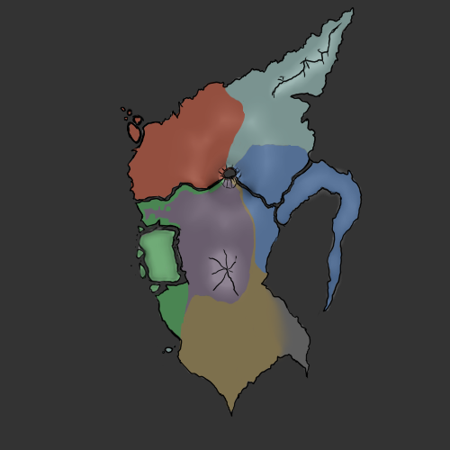
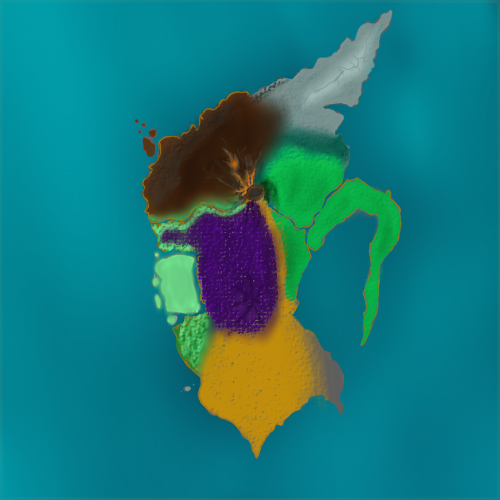
Regional map.
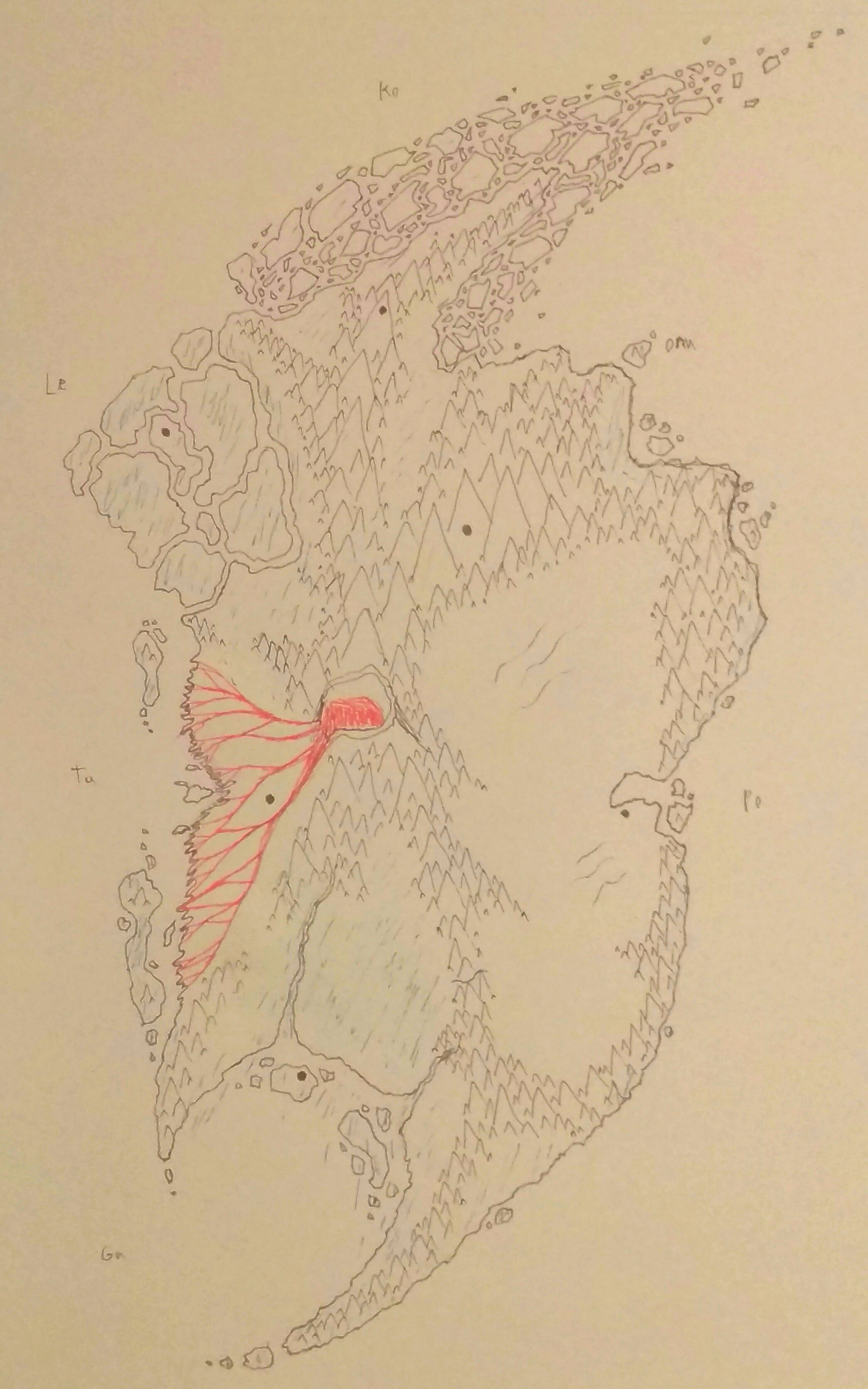
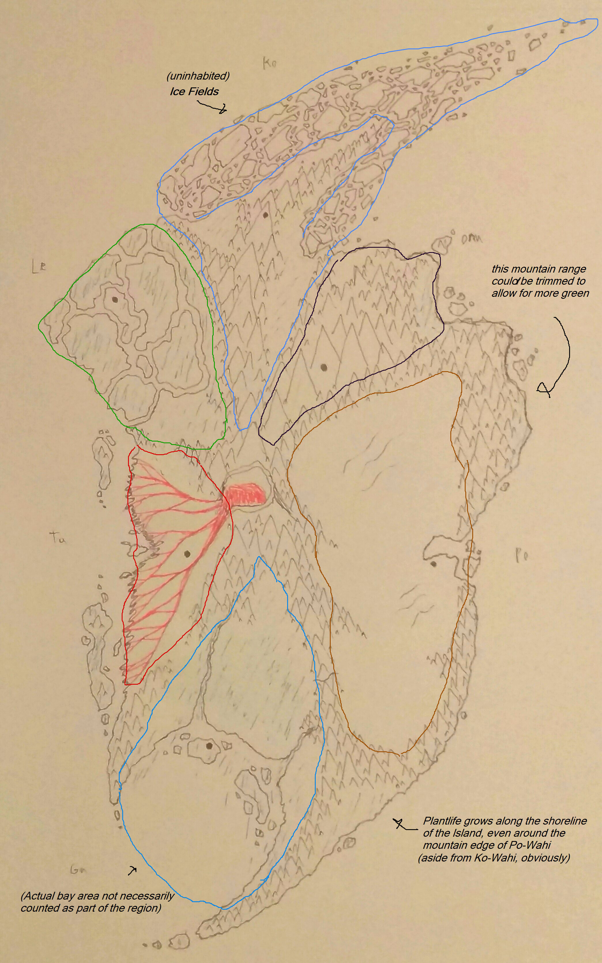
Map of the island.
A map of Onu’s underground caverns and tunnels.
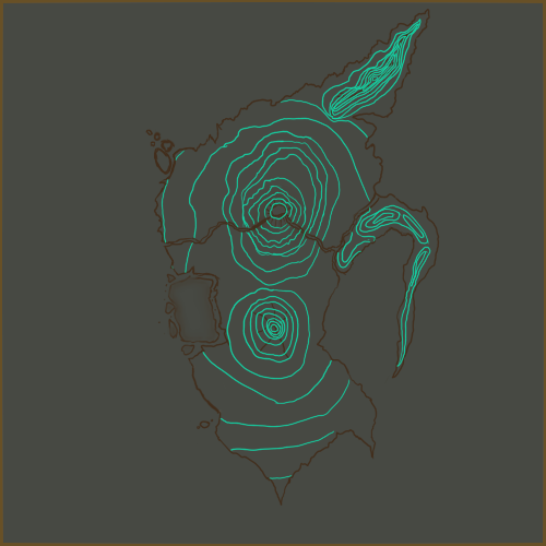
Ko and Ga have worked together to put forward a map of estimation on the height levels of the known island.
Project Members:
@Ghidora131
@Dallior
@Bobofoot
@Jakura_Nuva
See you around on the boards!