After hearing some of Brainstorm episode 19, I think I’ve pieced together a new possible island layout that fits all the various details that have been currently mentioned.
Current canon details about the island:
Mangai (specifically the volcano) is close to the island center.
Mangai and Ihu are separated by the volcano/volcanic ridges.
Mangai, Ihu, and Tiro all have access into Motara through the Merchant Gates.
Tahu exits Mangai in episode 2 script, and is in a forest (most likely Tiro).
Kanae can be found on the outskirts of the forest in episode 3 script.
Fan details:
Tiro forests should be fed by rivers from Naho. (My own thought)
Naho’s bay should be near Mangai instead of Ihu.
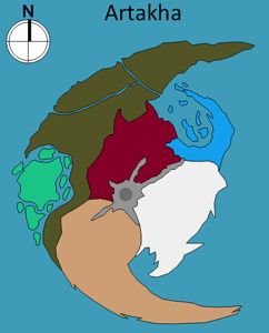
Island shape looks better when curved, and has a unique look to stand apart from islands in G1 and G2.
I was just looking for the map of the island to visualize where the things that were discussed in the podcast were, when you posted this topic. I think I like the shaping of Ven’s better but the distribution of the regions in yours (except I think Kanae should be in one place).
Maybe like this?
The main problem with Ven’s version is that it’s too similar to Mata-Nui, since he used that as a guide. I didn’t want to make one that was similar to an existing island.
As for Kanae, I feel the separate outposts fit their culture better with the leaving families and transportation.
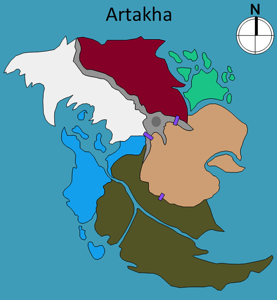
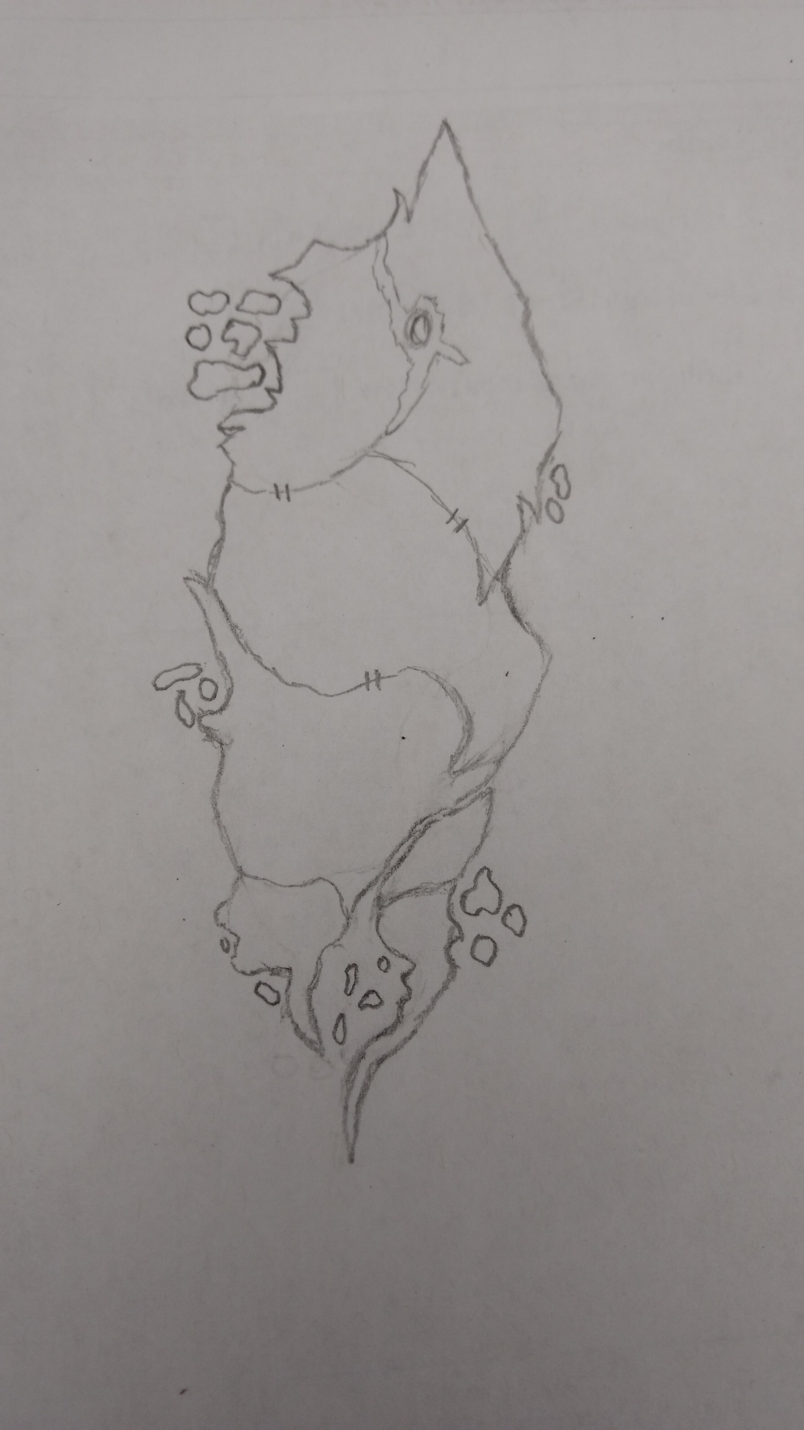
[Edid] - Here’s the original sketch I did. Everything was more vertical and the main section of Kanae was by Ihu. However, I still prefer the newer one.
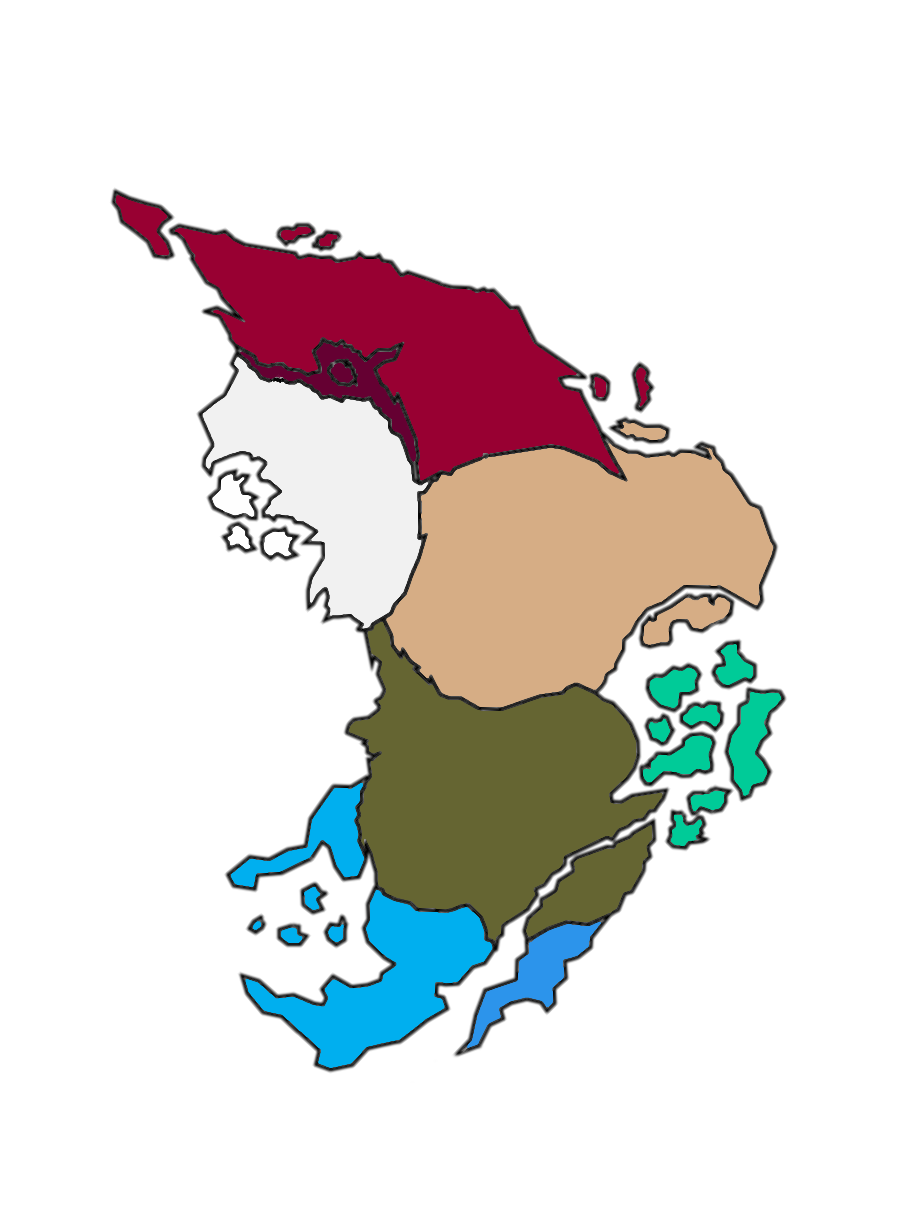
They don’t all have to be similar sizes. In fact, it makes more sense for some regions to be much smaller than others. Deserts and forests are naturally large areas, whereas volcanic areas are often confined to a certain perimeter around the volcano.
Kanae is made up of multiple floating rocks, so that will naturally be tiny. But the main cluster is about 90 miles wide, so there’s plenty of room for villages.
Like I say in the image, the total island (tip to tip) is about 600 miles. That equates to roughly 2 weeks of walking (for 14 hours each day). This matches their original idea of how long it would take to walk the whole thing.
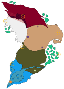
Though I appriciate your topic, I believe that @Oomatu has already made a map for Arthaka, which I believe is perfect. (Not because it looks good, because the geography of the Island makes sense.)
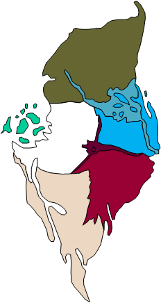
I designed this map to fit the current canon. In that canon, there are 3 gates into Motara. One from Mangai, one from Ihu, and one from Tiro. Oomatu’s design has Tiro on the north side of the island and Motara on the south. There is no possible way to have a gate between them.
I agree that Oomatu’s design looks amazing, but with this new detail, it runs into some issues, geographically. If you just mean the shape of the island, then that could be adjusted. This is a concept of the layout, so the exact shape can be tweaked.
I’ll play with the shape of my version a bit to curve it more. What are your thoughts on having outposts of Kanae at various points around the island vs just all together?
Floating at different points. I saw it as a way to tie in the Kanae matoran leaving their families early, as well as giving rest stops/bases for transportation all over the island.
[Edit] - I’ve updated the shape to reflect the more curved look that RAKRONDEWL made. I still kept the floating outposts for Kanae, but I increased the size of the main cluster to better differentiate it. (I also noticed I had the metric distances labeled as meters and not km.)
[Edit 2] - Just noticed the background was transparent instead of white, making the text harder to read.